
Apollo astronauts previewed their roles as lunar field geologists in Alaska’s Valley of Ten Thousand Smokes.
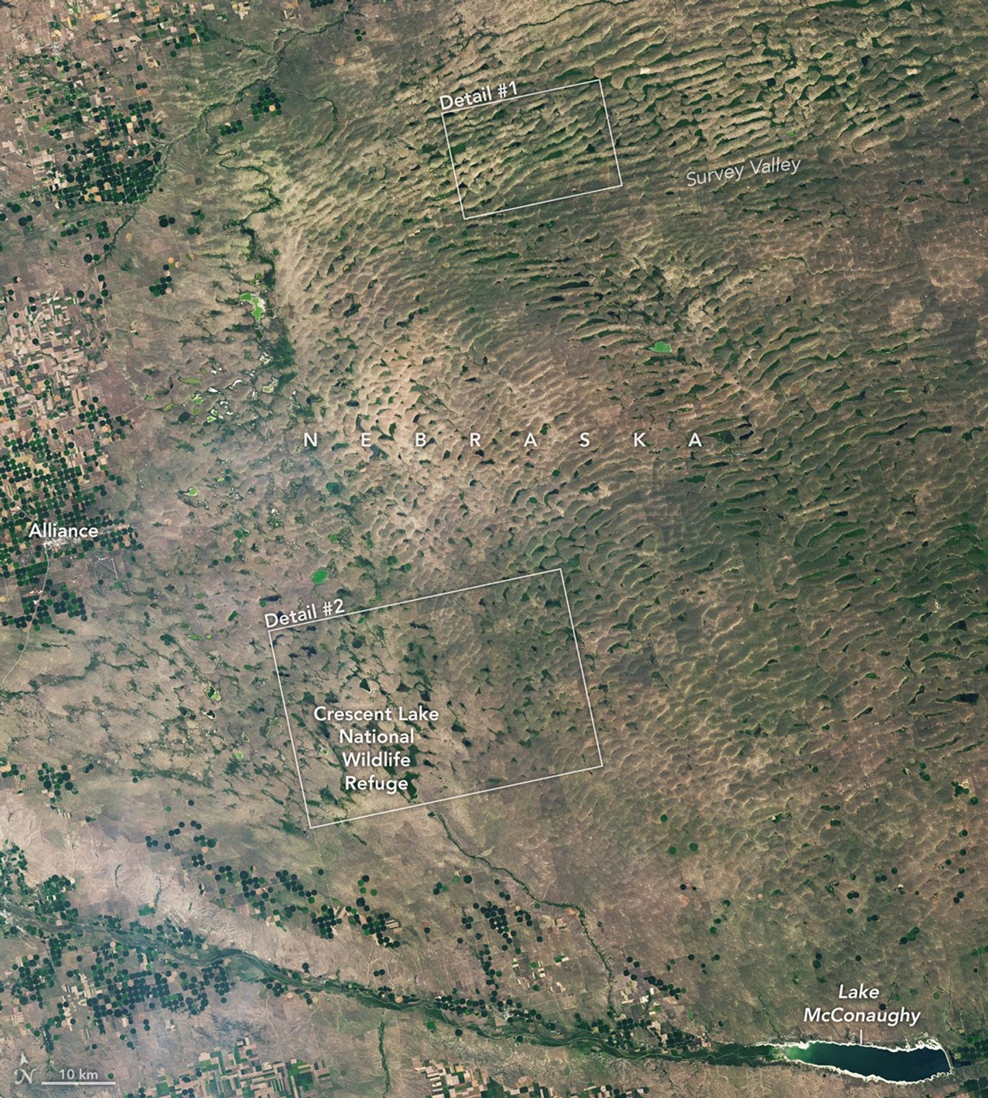
The Nebraska Sandhills—the largest system of sand dunes in the Western Hemisphere—stretch across about one-quarter of the state.

From a geothermal hotspot to the one-time “Lighthouse of the Pacific,” the heat is on beneath the volcanic landscape of western El Salvador.

Scientists relied on satellite data to understand how the Antarctic glacier lost so much ice so rapidly.

The coastal province features striking tropical karst landscapes and sandy beaches alongside a mix of natural land cover and developed areas.

The circular geologic feature in northwestern Africa can be hard to recognize from the ground, but it is obvious when viewed from space.

After the Laurentide Ice Sheet retreated from present-day Hudson Bay, rebounding land has revealed striking nearshore topography.

An early autumn storm left higher elevations in southern Argentina with a fresh and fleeting coat of white.

Ireland is best known for its many greens, but the striking grays of the island’s Burren region also stand out in satellite images.

Set amid El Salvador’s modern, active volcanic landscape, tranquil blue waters fill a caldera formed by ancient eruptions.