A persistent “gravity hole” beneath Antarctica gives scientists a window into Earth’s deep interior, showing how processes far below reshape the planet’s gravity field over millions of years.
…
New satellite imagery reveals that Doñana National Park, one of Europe’s most valuable wetlands, is shrinking so rapidly that it could disappear within a human lifetime.
…
Commodity Classic, February 25 – 27, 2026 Join NASA in the Exhibit Hall (Booth #3481) for Hyperwall Storytelling by NASA experts. Full Hyperwall Agenda below. WEDNESDAY, FEBRUARY 25 4:30 – 4:50 PMNASA: Your Space and Science AgencyKaren St Germain THURSDAY, FEBRUARY 26 11:00 – 11:20 AMInforming Water and Agricultural Management Apps with NASA Modeling and […]
Commodity Classic, February 25 – 27, 2026 Join NASA in the Exhibit Hall (Booth #3481) for Hyperwall Storytelling by NASA experts. Full Hyperwall Agenda below. WEDNESDAY, FEBRUARY 25 4:30 – 4:50 PMNASA: Your Space and Science AgencyKaren St Germain THURSDAY, FEBRUARY 26 11:00 – 11:20 AMInforming Water and Agricultural Management Apps with NASA Modeling and […]

Fishing boats illuminate the Arabian Sea along India’s west coast with green lights designed to attract squid, shrimp, sardines, and mackerel in this nighttime photograph from the International Space Station, orbiting 259 miles above Earth on Dec. 25, 2025. Studying nighttime light offers a unique perspective for investigations into human behaviors, such as tracking the […]
Fishing boats illuminate the Arabian Sea along India’s west coast with green lights designed to attract squid, shrimp, sardines, and mackerel in this nighttime photograph from the International Space Station, orbiting 259 miles above Earth on Dec. 25, 2025. Studying nighttime light offers a unique perspective for investigations into human behaviors, such as tracking the […]
As global tensions rise, the island has become a geopolitical pressure gauge, revealing how the old international legal order is beginning to fray.
…
ESA marked the opening of the 2026 Winter Olympics by capturing the venue from low-Earth orbit.
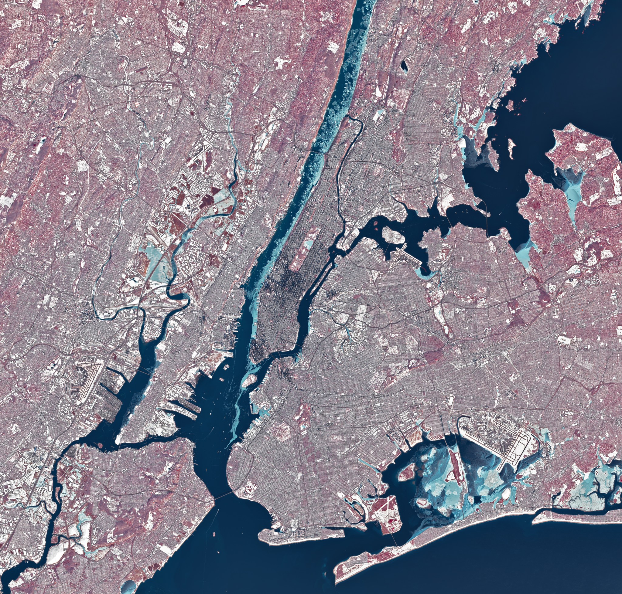
During a stretch of frigid weather in late January 2026, ice choked the Hudson River along Manhattan’s western shore. The OLI (Operational Land Imager) on Landsat 8 captured this image of the wintry landscape around midday on Jan. 28. This image uses representational color to distinguish ice (light blue) from open water and snow. Vegetation appears red. Much of […]
Five ways dismantling NCAR will cost the American people, and two ways to save it.